Bridge inspection, captured in 360°

Visual documentation made easy.

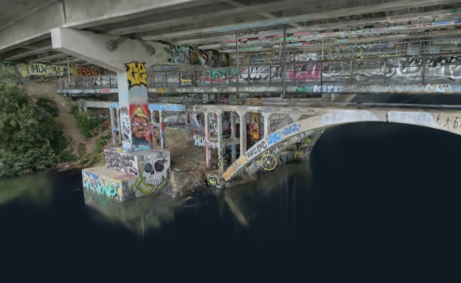
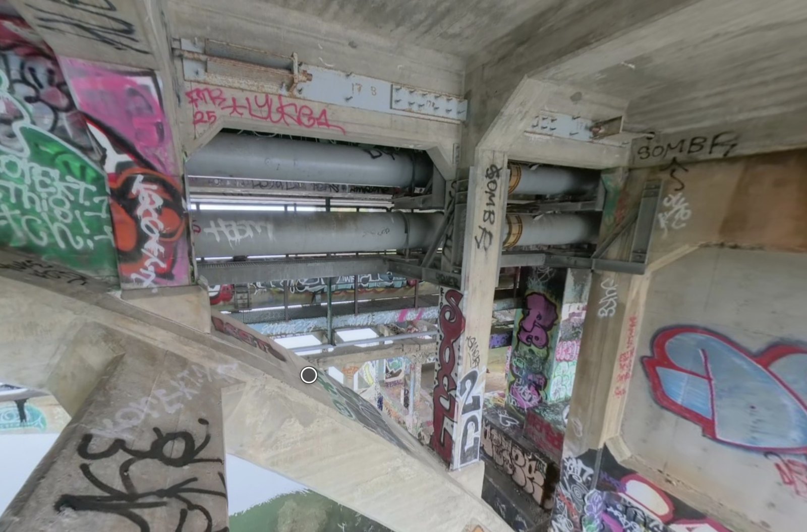
Fly the bridge once with a 360° drone. Bridge360 turns the footage into a lightweight 3D model that opens in any browser, with every spot the drone stopped available as a clickable, full-resolution 360° photo.

No software to install. Works on a laptop, a tablet, or a phone.
6 Mile Bridge · in the viewer
1flight
About an hour on site with a consumer 360° drone
3,418
360° frames from 57 minutes of footage on 6 Mile Bridge, every one placed in the model
17MB
The 3D model a client streams. It opens in seconds and runs on a phone
0
Apps to install. Sign in, open the model, walk the bridge
How the data is collected

One flight. One upload. A bridge you can walk.

Bridge360 is built so that any competent drone pilot can capture a structure, and an engineering firm can use the result the same week.

1

Fly

A pilot flies a consumer 360° drone, such as the DJI Avata 360, along, around and under the bridge. One steady pass each side, one along the soffit. Photo sets from a DSLR or a normal drone work too.

Pilot · about an hour on site
2

Upload and process

The pilot drops the video files into the portal. Our pipeline lines up every frame, builds the 3D model, cleans out stray noise and scores the run for quality before anything goes to the client.

Automatic · reviewed by us
3

Open in a browser

The client signs in, or follows a share link, and the whole structure loads in the browser. Walk it, step into any 360° photo, pin notes, measure, and share with colleagues.

Client · any browser, no install
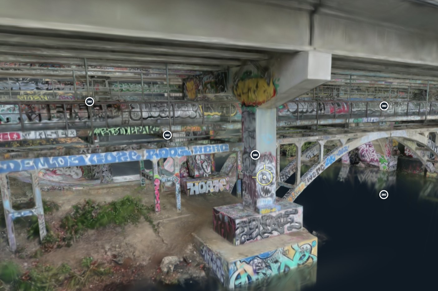
Capture tips we give every pilot. Lock ISO and shutter speed before flying under the deck so the soffit stays sharp, keep the drone moving slowly, and overlap each pass. The portal flags a weak run before it ever reaches the client.
The tools

Built for the people who inspect bridges, not for 3D specialists.

Everything runs inside the model in the browser. Nothing to learn beyond click and drag.

Walk the model

The whole structure as a photo-real 3D model. Orbit, fly along the deck, duck under the soffit, from any device.

360° stations

Every spot the drone paused is a station. Click it and you are inside the full-resolution 360° photo, looking at the real surface.

Photos tool

Click any point on the structure and see every photo that captured it. Open the original at full size.

Notes

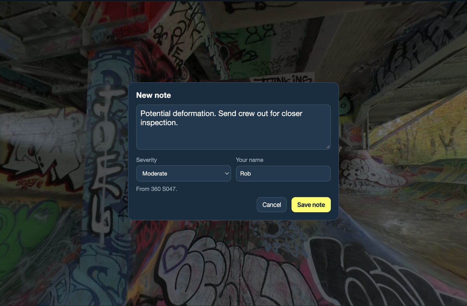
Pin a note exactly where the issue is, give it a severity, and the whole team sees it. Export all notes as a spreadsheet.

Measure

Click two points for a distance. Georeference the model to survey control points for real-world coordinates.

Compare visits

Swipe between two captures of the same bridge to see what changed since the last inspection.

Inspection views

Save the viewpoints that matter, so a colleague lands on the same pier, the same bearing, the same crack.

Guided tour

A quick tour inside the viewer shows new users what they can do. Most people are walking the bridge within a minute.

Share

One link opens the model for a client, a contractor or a council. No account needed, and nothing to download.

Get started

See your own bridge in Bridge360.

Send us one drone flight and we will send back a model you can walk. Or book a short demo and we will show you 6 Mile Bridge.